 Zodiac
 Armillary Sphere and Table of Declinations
(The angular distance to a point on a celestial object,
measured north or south from the celestial equator)
 Atlantic Ocean with portions of North America,
South America, Europe, and Africa
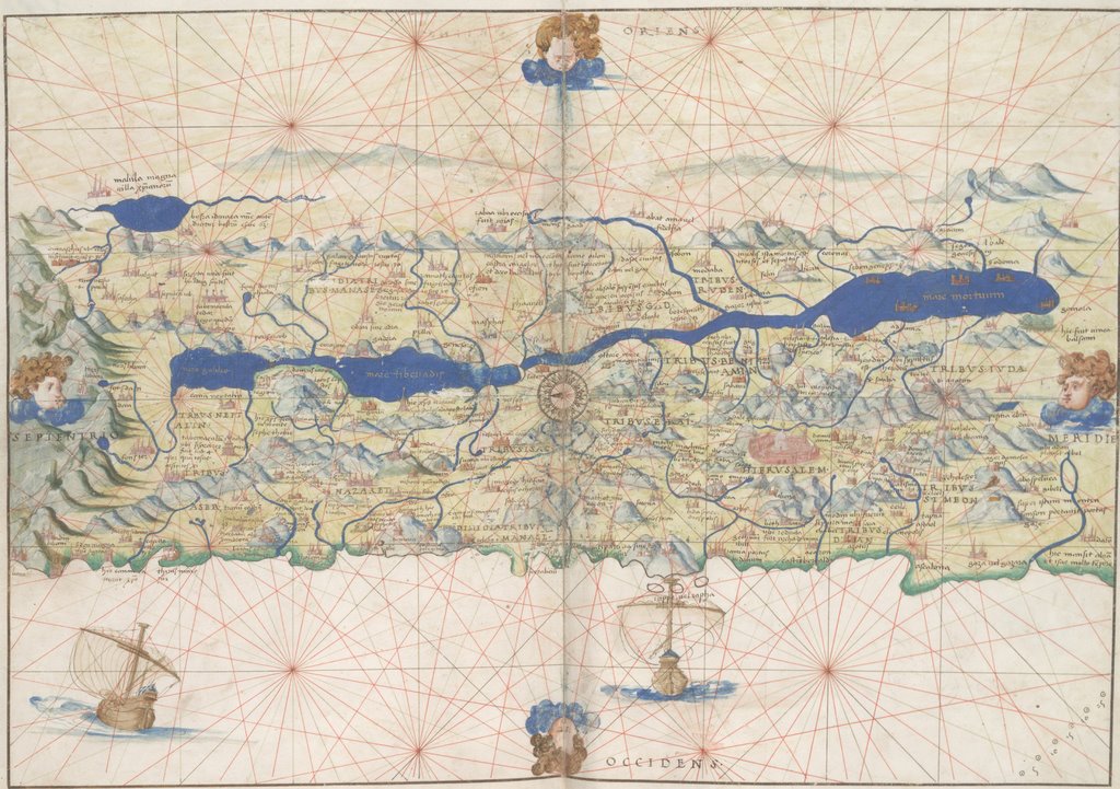 Palestine
 Italy and the Dalmatian Coast
 Pacific Ocean with portions of North America,
South America, Asia, and East Indies.
 Oval map of the world with wind heads
(showing the sea route chosen by Magellan
for his [near] circumnavigation of the world)
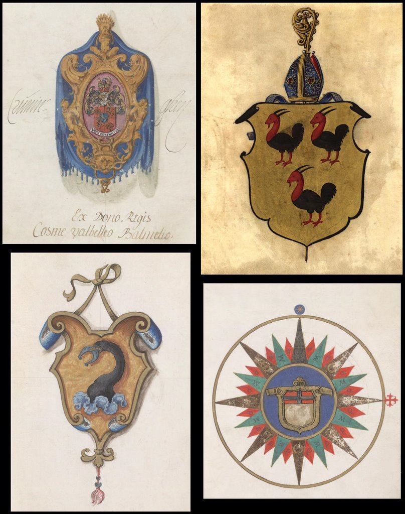 Coats of Arms from 4 Portolan Atlas owners
A portolan or nautical atlas (or chart, manuscript or map) refers to an early modern European rendering, usually on vellum, in which complete coasts, ports and waterways were depicted together with characteristic direction lines from the thirty-two points of the compass. Essentially they were hand-drawn, practical navigation aids prior to the days of accurate surveying and map engraving techniques.
The most famous of these is the Portolan Atlas of Battista Agnese of which about 70 copies are known to still exist. Agnese was active as a cartographer from 1535-1564, during the heyday of Italian mapmaking, in the leading shipping and trade centres of Genoa and Venice.
Although Agnese was more of a copier than an original cartographer, the Portolan Atlas is highly regarded for its precision, detail and artistic value. It was state of the art for its time with the latest explorations and discoveries and the ocean maps could be overlapped for comparison and to produce an accurate map of the world.
In addition to the cosmological and artistic embellishments and text, the series included 13 maps of the known world. As a luxurious production, the atlas was unlikely to have been used in practical navigation and was probably commissioned by a wealthy citizen originally. The version from 1546 is said to be the highest quality and is held today by the Russian National Library in St Petersburg. (I noticed in passing that a facsimile copy retails at >$2500)
The above images (click for larger versions) come from a number of different manuscripts.
- The Huntington Library at the University of California have 4 versions: I (I think this is the best), II, III, IV - available in multiple sizes.
- The Library of Congress has another version, also with huge images available.
- NYPL has a different atlas again but the large images are smaller than screen size.
- Finns Books have probably the best summary/biography.
- Library of Congress summary.
- Description from University of Pennsylvania Library.
[There has been a slight truncation problem with the RSS feed on a few occasions in the last couple of months, including yesterday - that's a Blogger glitch for unknown (to me) reasons. So I haven't been tweaking anything. 99% of the time it all runs smoothly.]


3 comments :
those are great. i love old innaccurate maps; the only thing that's missing is "here there be dragons." :)
--
http://www.scarletstarstudios.com/
Thanks for pointing these out.
I wonder how much of our current understanding of the universe is similarly flawed like these early maps...
Have I told you lately that I loved you?
thanks humungous for the Visboek , as a true Dutch i luuuuv it.
hugo picked it out , if you clash againt pure dutch gems ,please bear me in your mind if it is not filled yet.
Post a Comment
Comments are all moderated so don't waste your time spamming: they will never show up.
If you include ANY links that aren't pertinent to the blog post or discussion they will be deleted and a rash will break out in your underwear.
Also: please play the ball and not the person.
Note: only a member of this blog may post a comment.