Châlons-en-Champagne
 - engraving 1630.
The original cartographic maps were crude endeavours carved in wood (the end of the 15th century) that were limited in the detail they could sustain and the length of time they lasted. With the development of metal engraving during the 16th and 17th centuries, better quality charts were prepared, primarily for civil and military administrators. In the 19th century, lithography allowed for low cost reproductions and maps became available to a wider section of the population beyond the elite. The pressures of industrialization and competition for land resources were a secondary reason maps became more easily available.
 Plan de Mézières pour servir au projet de 1724
.
Under the
Ancien Régime (old feudal/royal order) engineering corps constructed fortifications for city protection and to house new armaments. Maps were drawn for planning upkeep, for use during the actual construction on the ground and copies were also held by the King in Paris. Further copies were often made for warfare chronicles and for private collections.
 Carte des environs de Troyes pour servir à désigner la situation des lieux où les chanoines réguliers de la Trinité ont leurs héritages et propriétés
 - 18th century.
Surviving feudal maps from the
Ancien Régime which were made for the religious and civil nobility display not only land usage and hunting rights at the time, but they also allow modern geocartographers some historical insight into regional forest, water and land management.
(2 more rural land use maps below)
 Les villages des Granges et de Vanlay
, 1699.
 Eaux et forêts de Troyes
 - 18th century.
Water and forestry map.
 Carte générale des chemins de fer de la Champagne et de l'Aisne publiée par Matot-Braine
.
Lithograph - 1859.
Major transport routes had been built during Roman times and little in the way of upkeep or extension was undertaken until the latter half of the 18th century. An administrative department for roads and bridges was established in 1716 and a proliferation of transport maps followed. Originally these maps helped with the planning of roadworks, but inland waterways - still the major transportation route for rural products or goods from the city - became an increasingly important cartographic feature. Finally, once the major inter-regional roads were constructed during the 19th century and mapping techniques became more widely known, cartographers came to include the railways - burgeoning communication networks called for charts relating to tourism, statistical and economic themes.
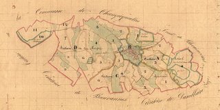 Tableau d'assemblage du plan cadastral parcellaire de Germainvilliers
.
Probably late 18th-early 19th century.
In 1791, following the Revolution, a huge cadastral (registration of ownership and value of lands) project was commenced across France. Precise knowledge of property size and land ownership was to assist with adminstrative procedures such as taxation. The vast cartographic enterprise that augmented the written records didn't properly begin until ~1807 and wasn't completed until ~1850.
 Plan de la seigneurie des Noës
. Troyes.
17th century feudal map on parchment - said to have been a sign of distinction in general cartography as most (non-marine) maps were printed on paper by that stage.
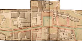 Canal de la Haute-Seine - Ville de Troyes, projet d'alignement approuvé en 1806 Saguery, fait par l'ingénieur en chef du département de l'Aube [plan des canaux et du port de flottage de Troyes]
.
Maps in relation to industrial and agricultural usage were/are within the purview of the local authorities and in this case, the map shows approved canal changes in the early 19th century.
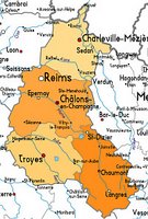
The Champagne-Ardenne region of France is directly east of Paris.
All the material above comes from Terres de Champagne-Ardenne: Cinq siècles de cartographie, a Troyes library website posted in conjunction with an exhibition they are having between April and June this year.
All the words here are mine and are a product of my own translations, deductions, reasoning, web reading and some web translations. So I recommend you sprinkle on some salt prior to digestion. This is an excellent website and I've only provided a few mouthfuls from an otherwise sumptuous meal for those of the cartohistoriological persuasion. More power to francophonic visitors.
Apart from this final map (which comes from
here) I've uploaded full size files so click on the images above for a larger view. It's a mostly flash website using
Zoomfiy making extraction of images/image details a bit difficult. Some of the
Zoomify boxes and library stamps have been removed from the background.
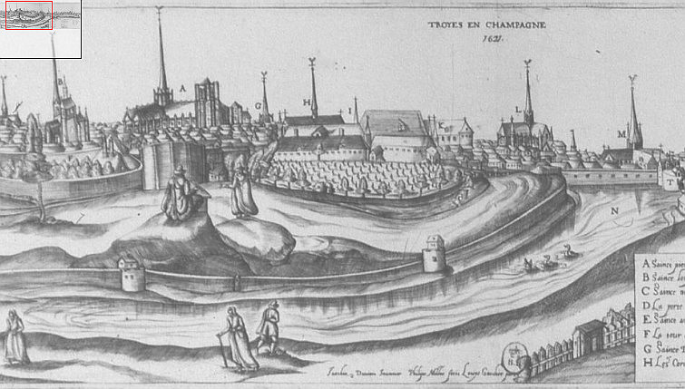 Châlons-en-Champagne - engraving 1630.
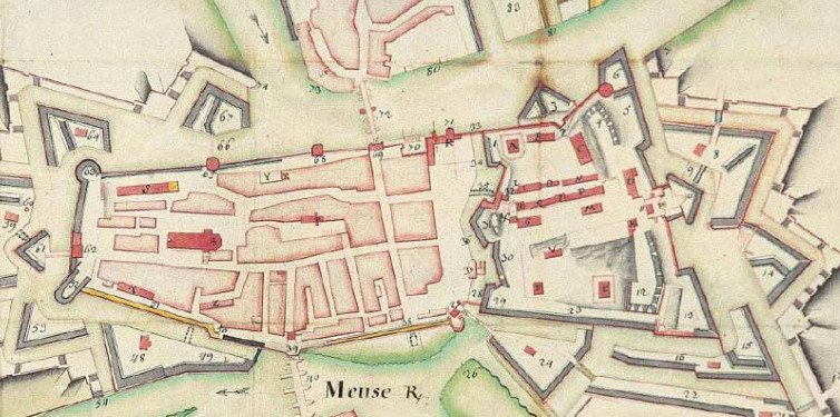 Plan de Mézières pour servir au projet de 1724.
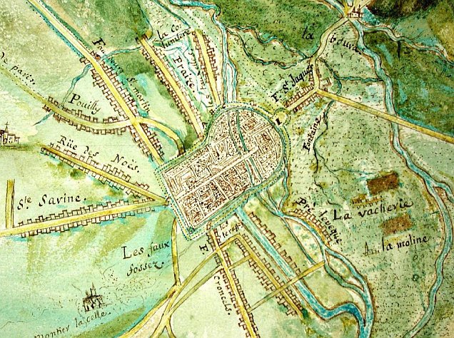 Carte des environs de Troyes pour servir à désigner la situation des lieux où les
 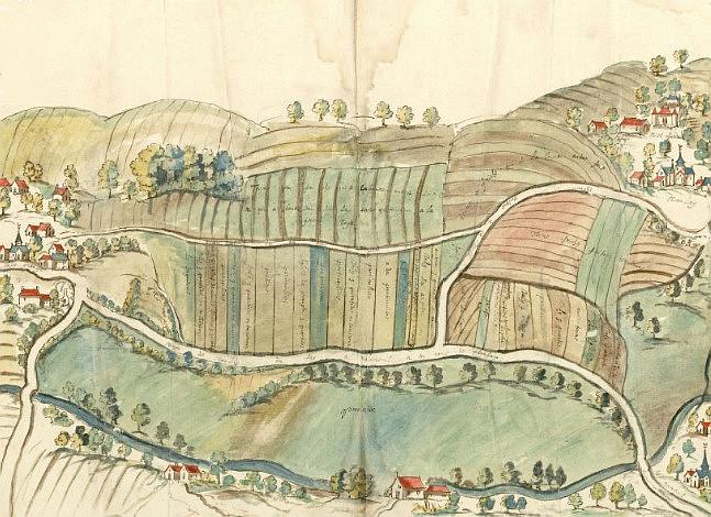 Les villages des Granges et de Vanlay, 1699.
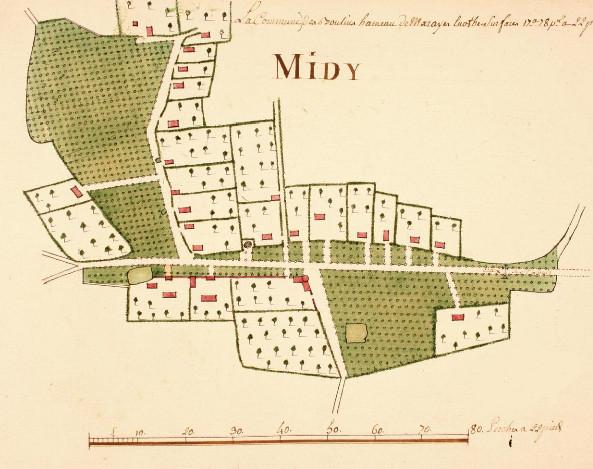 Eaux et forêts de Troyes - 18th century.
 Carte générale des chemins de fer de la Champagne
  Tableau d'assemblage du plan cadastral parcellaire de Germainvilliers.
 Plan de la seigneurie des Noës. Troyes.
 Canal de la Haute-Seine - Ville de Troyes, projet d'alignement
  The Champagne-Ardenne region of France is directly east of Paris. All the material above comes from Terres de Champagne-Ardenne: Cinq siècles de cartographie, a Troyes library website posted in conjunction with an exhibition they are having between April and June this year.