Illustrations of decorative atlas front matter pages
sourced from the incomparable Rumsey site [see Part ONE]
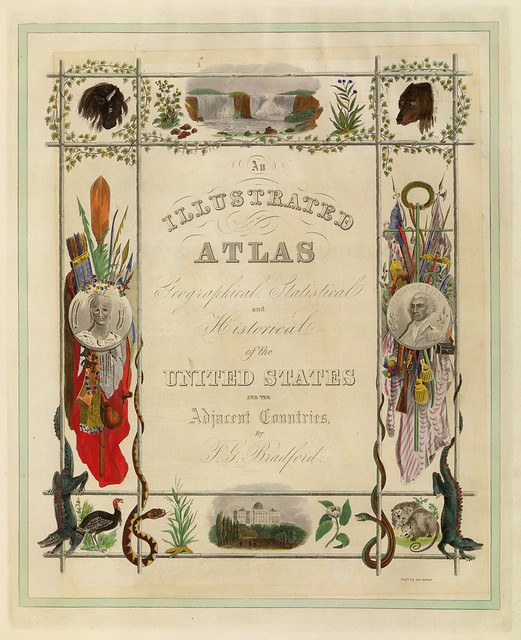
Title: An Illustrated Atlas, Geographical, Statistical, And Historical, Of The United States And The Adjacent Countries
Author: TG Bradford
Date: 1838
Notes: This is Bradford's best atlas, far superior to the smaller and more crudely drawn Comprehensive Atlas. The maps are engraved by G.W. Boynton, except for Mississippi, which is engraved by S. Stiles, Sherman and Smith. There is a beautifully illustrated, engraved second title page in full hand-painted colour.
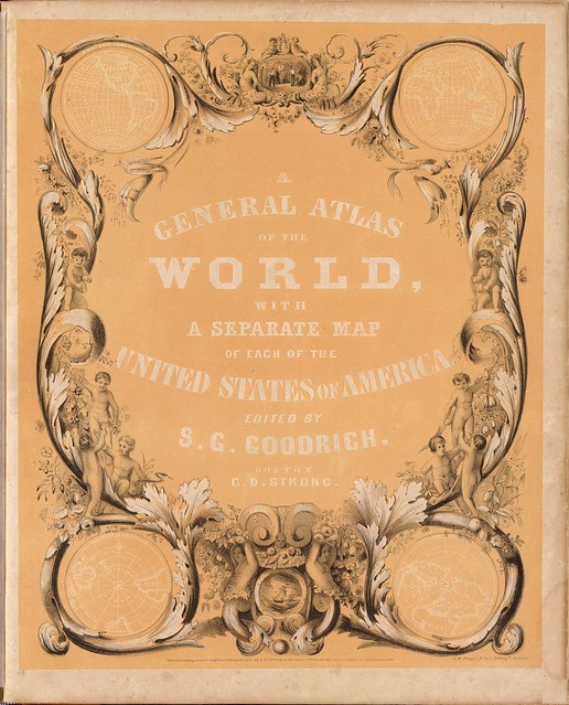
Title: A General Atlas Of The World, With A Separate Map Of Each Of The United States Of America
Author: TG Bradford & SG Goodrich
Date: 1841
Notes: This is the Bradford 1838 Illustrated Atlas, without the text and with the addition of ten maps: two hemispheres, South America, Atlantic Ocean, Europe (3), Africa, Asia, and Pacific Ocean. Why Bradford's name is dropped is a mystery, although Goodrich in 1842 issued a new edition of the Illustrated Atlas with Bradford that retains the text and adds the same new maps that are added here. However, many of the maps in this 1841 edition are somewhat different from the 1838 and 1842 editions, with the usual changes in counties, etc.
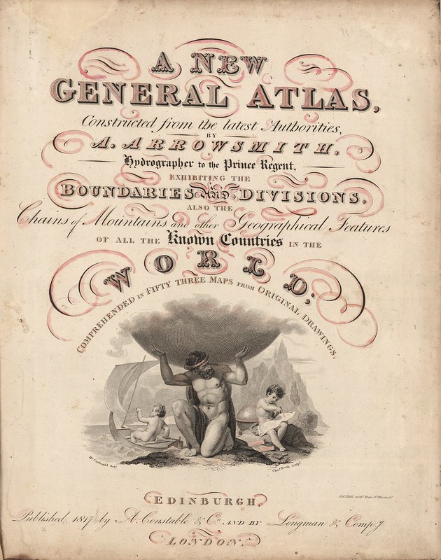
Title: A New General Atlas, Constructed from the latest Authorities, By A. Arrowsmith, Hydrographer to the Prince Regent, Exhibiting The Boundaries And Divisions, Also The Chains of Mountains and other Geographical Features Of All The Known Countries In The World; Comprehended In Fifty Three Maps From Original Drawings
Author: Aaron Arrowsmith
Date: 1817
Notes: This complete atlas features an index and 53 copperplate maps, drawn by Arrowsmith and engraved by Sidney Hall, with a few engraved by Thomson in collaboration with Hall. The maps include two of the world, 29 related to Europe and Scandinavia, 16 on Asia, Africa, and Oceania, and six related to the Americas. The United States map shows Georgia extending from the coast to the Mississippi River. The area west of the Mississippi is blank and labeled Louisiana. The engraved title page features [the Greek God] Atlas holding up a globe above two putti. One putto sails in a dinghy and the other is studying with cartographic tools. {The reddish--rose coloured shading on the letterforms appears to be later watercolour vandalism}
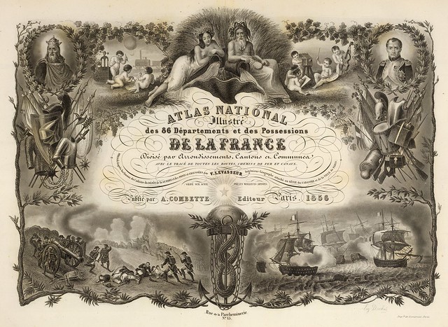
Title: Atlas National De La France
Author: Victor Levasseur
Date: 1856
Notes: Lavishly illustrated (steel engraving) title page margins showing heroes, battles, weaponry, and cherubs. This atlas is noteworthy for its beautiful illustrations in the borders of the maps. It was one of the last of the decorative map atlases of the 19th century.
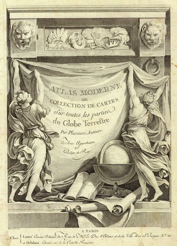
Title: Atlas moderne ou collection de cartes sur toutes les parties du globe terrestre ar plusieurs auteurs Avec approbation & privilege du Roy. A Paris, Chez Lattre Graveur Ordinaire du Roy, de Mgr. Le Duc d'Orleans et de la Ville Rue St. Jacques No. 20. et Delalain Libraire, rue de la Comedie Francoise. Monnet del. 1762. Prevost Sculp. Pub Reference
Author: Ribogert Bonne & Jean Lattre
Date: 1791
Notes: Maps by Bonne, Janvier, & Rizzi Zannoni. Late edition which includes important maps of the United States, British America, and Mexico which do not appear in the earlier editions.
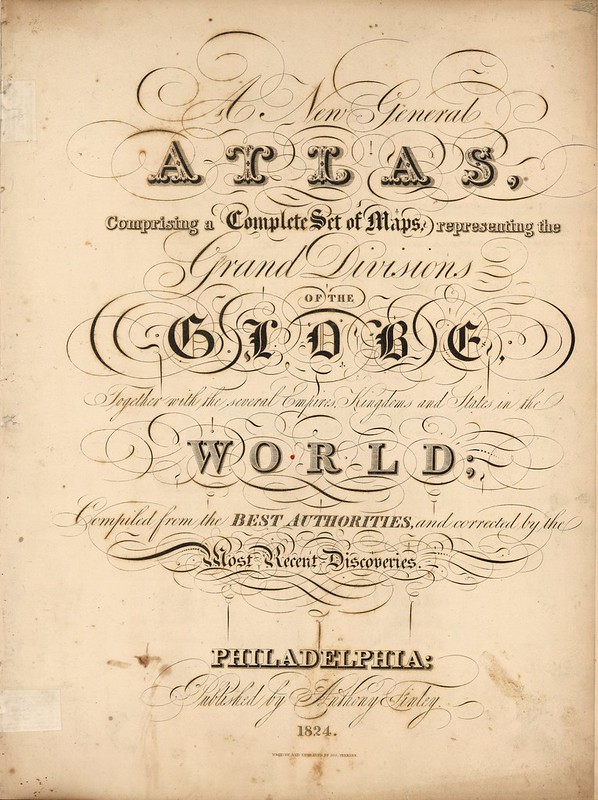
Title: A New General Atlas Comprising a Complete Set of Maps, representing the Grand Divisions Of The Globe, Together with the several Empires, Kingdoms, and States in the World; Compiled from the Best Authorities, and corrected by the Most Recent Discoveries
Author: Anthony Finley
Date: 1824
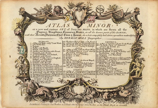
Title: Atlas minor: or a new and curious set of sixty-two maps, in which are shewn all the empires, kingdoms, countries, states, in all the known parts of the earth; with their bounds, divisions, chief cities & towns, the whole composed & laid down agreable to modern history
Author: Thos. & John Bowles
Date: 1736
Notes: Contains 62 hand col. double-page engraved maps (10 folding). The maps in the third ed. are similar to those of the 2nd, except that a number of the American maps contain added place names. Like most of Moll's works, the majority of the maps are undated [but include] a map of America showing California as an island.
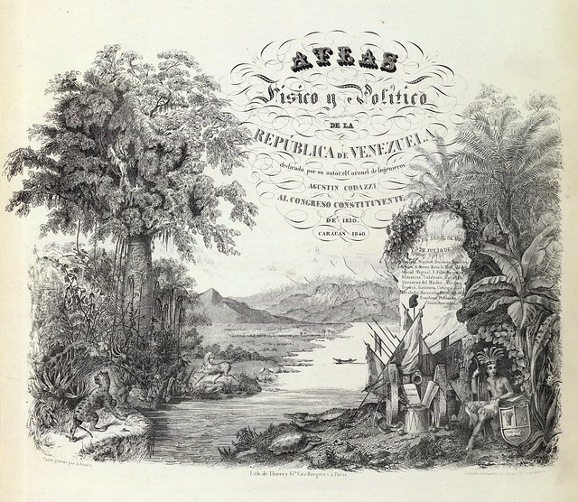
Title: Atlas fisico y politico, Republica de Venezuela
Author: Agustin Coduzzi
Date: 1859
Notes: This is the first national atlas of a South American country listed in Phillips. It is also an early example of the use of lithography in atlases, predating the first North American lithographed atlas (Mitchell) by six years. There are 30 full colour detailed political and physical maps on 18 sheets. In addition to the maps, there is a beautiful lithographed title page and a striking mountains and rivers plate.
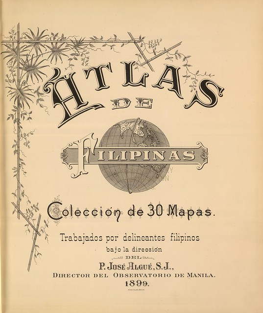
Title: Atlas de Filipinas. Coleccion de 30 Mapas. Trabajados por delineantes filipinos bajo la direcion del P. Jose Algue, S.J., Director del Observatorio de Manila
Author: Jose PAlgue; U.S. Coast and Geodetic Survey
Date: 1899
Notes: Maps drawn in Phillipines, published in U.S.
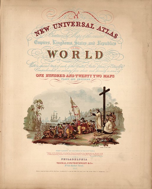
Title: A New Universal Atlas Containing Maps of the various Empires, Kingdoms, States and Republics Of The World. With a special map of each of the United States, Plans of Cities &c. Comprehended in seventy sheets and forming a series of One Hundred And Seventeen Maps, Plans And Sections
Author: HS Tanner
Date: 1836
Notes: This atlas was published by Tanner to reach a broader market (i.e. less expensive) than his earlier large format American Atlas, with smaller pages and expanded coverage of non American areas. It was first issued in parts, beginning in 1834.
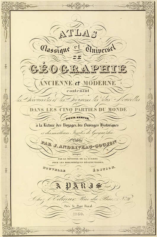
Title: Atlas classique et universel de geographie ancienne et moderne, contenant les decouvertes et les divisions les plus nouvelles dans les cinq parties du monde pour servir a la lecture des voyages, des ouvrages historiques et des meilleurs traites de geographie
Author: J Andriveau-Goujon
Date: 1850
Notes: Has the 5 wonderful Solar System plates. Large paper copy. Plates hand coloured.
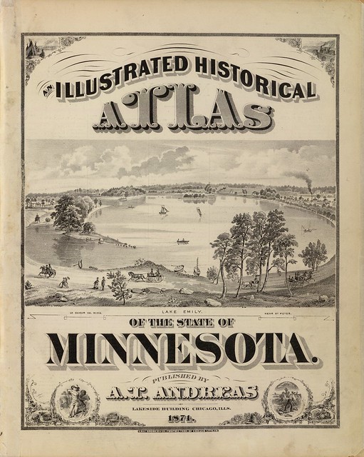
Title: An illustrated historical atlas of the State of Minnesota. {view of} Lake Emily, Minn. near St. Peter [Le Sueur Co.]
Author: AT Andreas
Date: 1874
Notes: Hand painted and printed in full colour.
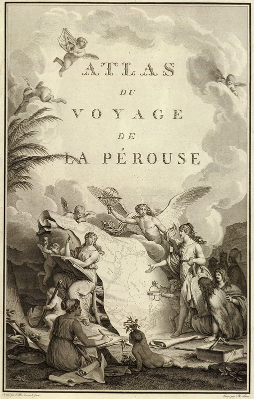
Title: Atlas du voyage de La Perouse
Author: Jean-Francois de Galaup, Comte de La Perouse
Date: 1797
Notes: Engraved, illustrated title page. Some figures looking at unfolding map entitled: Developement de la route de La Perouse. La Perouse set sail from France in 1785 to continue the discoveries of Captain Cook. He was shipwrecked in 1788 but his narrative, maps, and views survived and were published.
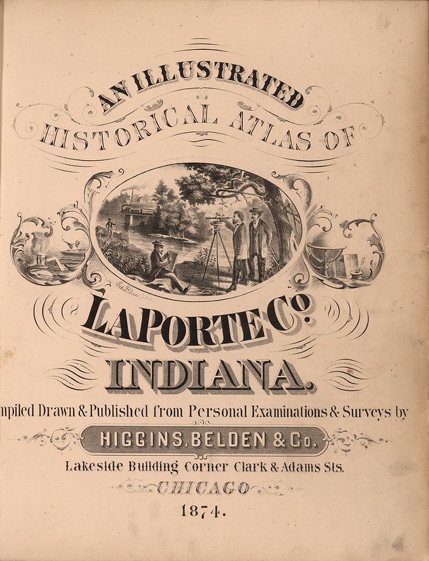
Title: An Illustrated Historical Atlas Of LaPorte Co. Indiana. Compiled Drawn & Published from Personal Examinations & Surveys by Higgins, Belden & Co.
Author: Higgins, Belden & Co.
Date: 1874
Notes: Many views, several of which have extensive biographical text with them. Higgins, Belden & Co. published five county atlases, all in Indiana. This is one of the most elaborate and attractive county atlases we have seen. Full colour. At the end is a full printed colour Rand McNally folding map of the United States which has appeared in several county atlases and other atlases and gazetteers of the period.
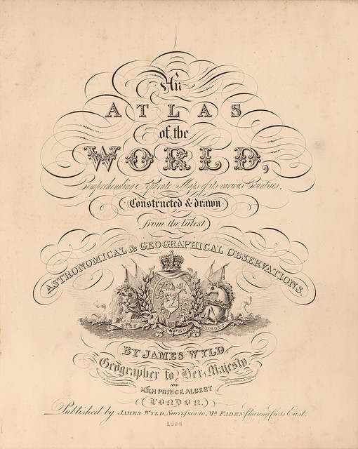
Title: An Atlas of the World, Comprehending Separate Maps of its various Countries, Constructed & drawn from the latest Astronomical & Geographical Observations
Author: James Wyld
Date: 1864
Notes: A late edition of this atlas, published as early as 1836 (see our copy). Several new maps of Australia and South Africa are added and the other maps have been updated to show railroad development. The American maps have been updated, but inadequately so in the West - the River Buenaventura is still flowing out of Salt Lake on the Mexico Map. Maps in colour.
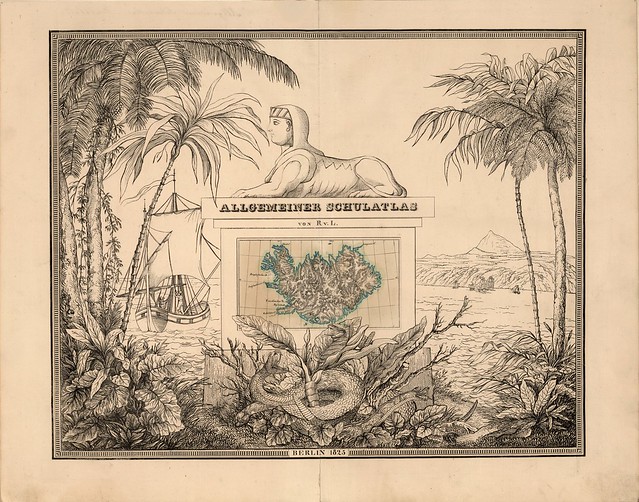
Title: Allgemeiner Schulatlas
Author: August Ruhle von Lilienstern
Date: 1825
Notes: Lavishly illustrated title page with scenes from the natural world including rattle snakes, palm trees, volcano and tropical plants. Includes cultural features such as ships, the sphinx, and a hachured relief map of Iceland outlined in teal colour. In German. Remarkable for "the most fantasy-rich title page to be found in any German atlas" (Espenhorst). This atlas is, according to the author, Ruhle von Lilienstern, "expressly designed for use in the schools" and was ahead of its time in depicting hydrography and topography without place names and cultural or political features. The author's motivation was to use an effective presentation style for surface terrain. The rendering of relief was particularly innovative and precedent setting. Unfortunately, this atlas was not embraced by teachers, who remained focused on the political aspects of geography. Nonetheless, Ruhle was devoted to military and public geographic education and he had, according to Espenhorst, the goal "to create in the Prussian people the spirit, the will, and the capability to participate in war." The atlas also suffered from flights of fancy on filling in unexplored regions of the earth, a practice which lead to criticism and which detracted from the outstanding physiographic or oro-hydrographic depictions. The author was also one of the first to employ lithography to produce large format atlases. As a general, writer and diplomat, he was very successful. While his success as a cartographer was challenged, his contributions are certainly noteworthy.
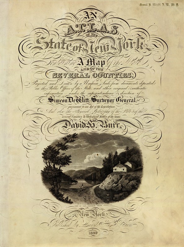
Title: An atlas of the State of New York, containing a map of the State and of the several counties ... under the superintendance & direction of Simeon DeWitt, Surveyor General, pursuant to an Act of the Legislature, and also the physical geography of the State & of the several counties & statistical tables of the same
Author: DH Burr
Date: 1829
Notes: This atlas is the second atlas published in the 19th century of one of the individual states in the U.S., preceded only by Mill's Atlas of South Carolina, issued in 1825, and followed closely, also in 1829, by Greenleaf's Atlas of the State of Maine.
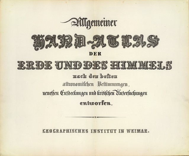
Title: Allgemeiner Hand-Atlas der Erde und des Himmels nach den besten astronomischen Bestimmungen, neuesten Entdeckungen und kritischen Untersuchungen entworfen
Author: Geographisches Institut (Weimar, Germany)
Date: 1856
Notes: Maps by C.F. Weiland, H. Kiepert. All maps engraved, dated variously from 1846 to 1856. This is a marvelous atlas, full of interesting details - the U.S. maps refer to "Utah Territory - Deseret." Most maps with outline colour.
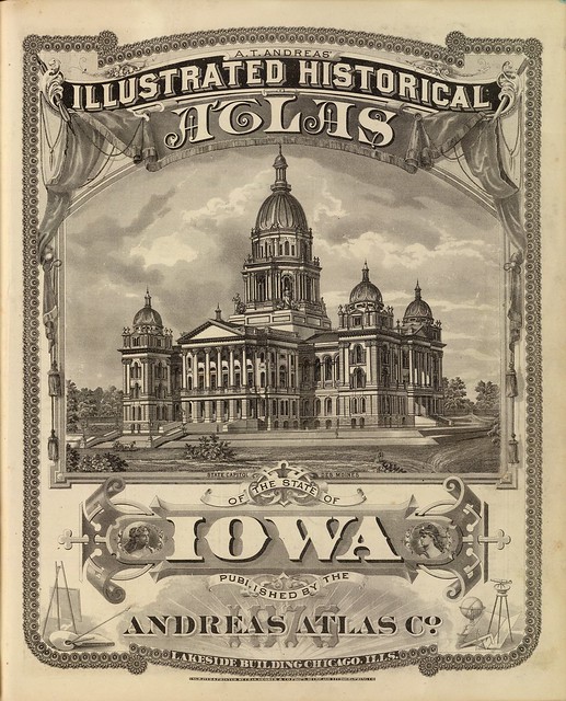
Title: A.T. Andreas' illustrated historical atlas of the State of Iowa.
Author: AT Andreas (Andreas Atlas Co.)
Date: 1875
Notes: Illustrated lithographed title page. State Capitol view measures 22 x 28 cm. (inside borders).
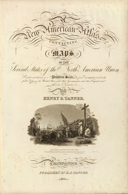
Title: A New American Atlas Containing Maps Of The Several States of the North American Union, Projected and drawn on a Uniform Scale from Documents found in the public Offices of the United States and State Governments, and other Original and Authentic Information
Author: HS Tanner
Date: 1823
Notes: The first edition with the earliest states of all the maps. Many believe this to be the finest atlas published in the United States in the 19th century. The text essay is a wonderful compilation of information on the contemporary maps that Tanner used as sources. Tanner updated the maps frequently over the next two decades, and issued several editions or compilations of the atlas with the title pages.
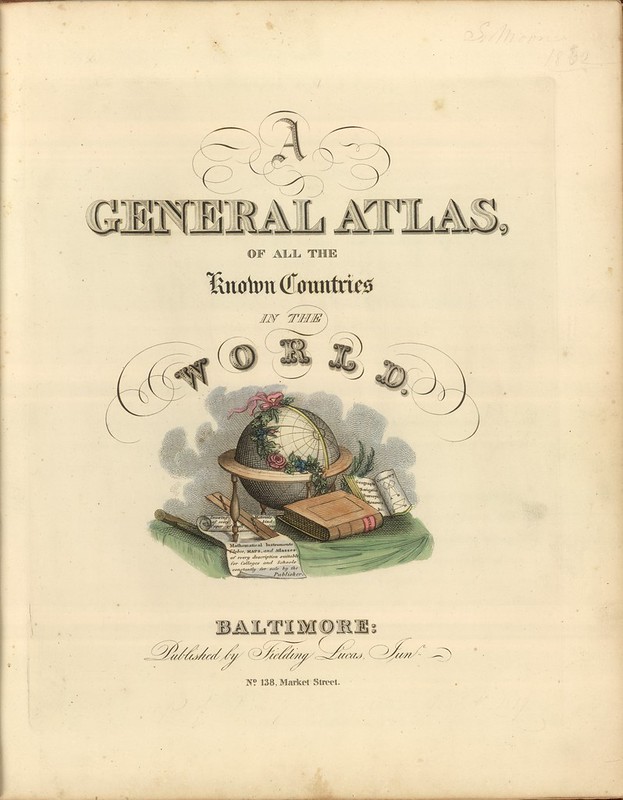
Title: A General Atlas, Of All The Known Countries In The World
Author: Fielding Lucas Jr.
Date: 1822
Notes: This is a very unusual Lucas atlas - according to Foster, only two copies are known. The engraved title page shows a globe and books on a table, with pages open listing Lucas' products: "Drawing Materials of every kind, Paper of all sizes, Mathematical Instruments, Globes, Maps, and Atlases of every description suitable for Colleges and Schools constantly for sale by the Publisher."
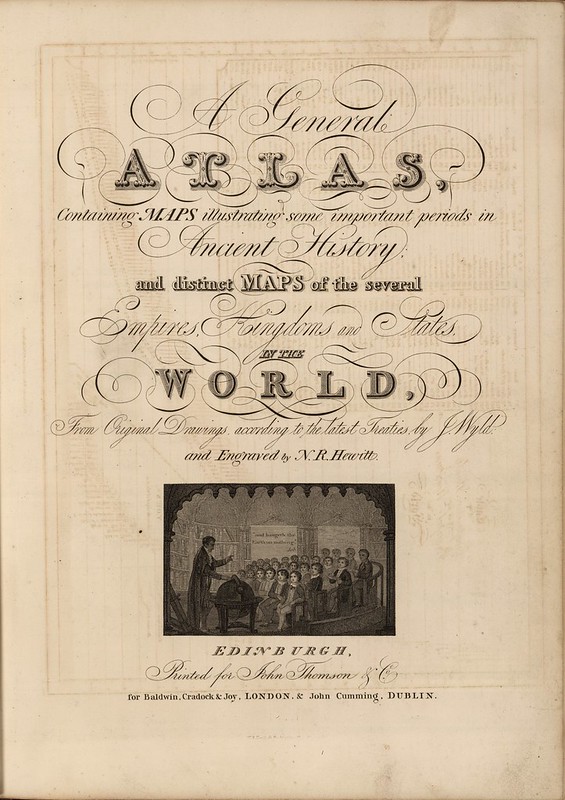
Title: A General Atlas, Containing Maps illustrating some important periods in Ancient History; and distinct Maps of the several Empires, Kingdoms and States In The World, From Original Drawings according to the latest Treaties by J. Wyld and Engraved by N.R. Hewitt. Edinburgh, Printed for John Thomson & Co for Baldwin, Cradock & Joy, London & John Cumming, Dublin.
Author: James Wyld (nb. see above) & John Thompson
Date: 1824
Notes: This is the second edition and includes the extra map of the Arctic and two extra maps of Australia. The text adds a section on Voyages of Discovery. Two additional maps are laid in, one of South America, the other of Mexico. {nb. another title page from Wyld ~7 images up}
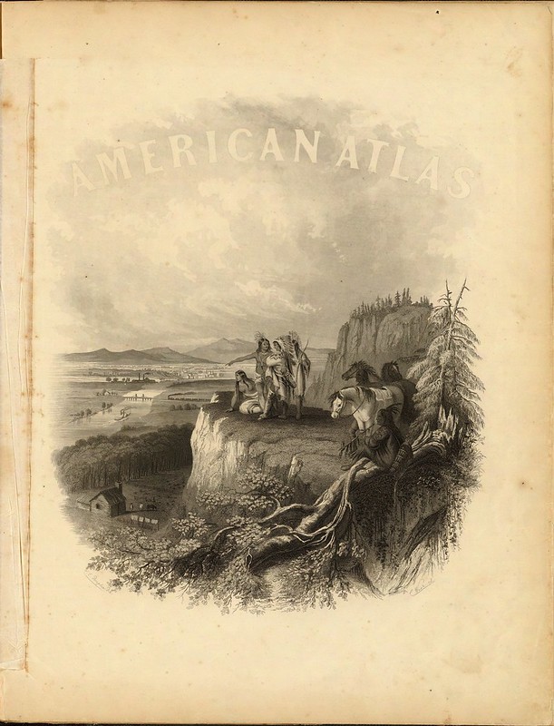
Title: (Half Title Page to) Johnson's New Illustrated (Steel Plate) Family Atlas, With Descriptions, Geographical, Statistical, And Historical. Compiled, Drawn, and Engraved Under The Supervision Of J.H. Colton And A.J. Johnson. New York
Author: AJ Johnson
Date: 1860
Notes: Title on page reads "American Atlas" and is accompanied by an illustration of Indian on a bluff overlooking a river, town and homestead. 1st Edition, 1st issue. Most of the maps come from Colton's 1859 edition of the General Atlas, published by Johnson and Browning.
{The images have been cropped from their source files but are otherwise
unaltered. The notes are lightly edited quotes from the source site}
- All these images come from the wonderful David Rumsey Maps site.
- Mr Rumsey was interviewed during the week for a PBS segment on digital mapping as noted (and embedded) on the Rumsey blog.
- Please see the earlier post on this topic - Atlas Title Pages Redux ONE - for some interesting background links.
- Previously, in general: cartography.
Something I've been wondering this last week or so: are there other digital philanthropists comparable to David Rumsey (whom I seem to recall describing hereabouts as a hero previously)?? I know there are longstanding bequests through universities etc that are used to place cultural material online, but are there contemporary people out there funding digitisation projects, specifically, as Rumsey does?? Do institutions lobby potential benefactors for support on single projects or particular subjects?? I have no idea.


No comments :
Post a Comment
Comments are all moderated so don't waste your time spamming: they will never show up.
If you include ANY links that aren't pertinent to the blog post or discussion they will be deleted and a rash will break out in your underwear.
Also: please play the ball and not the person.
Note: only a member of this blog may post a comment.