
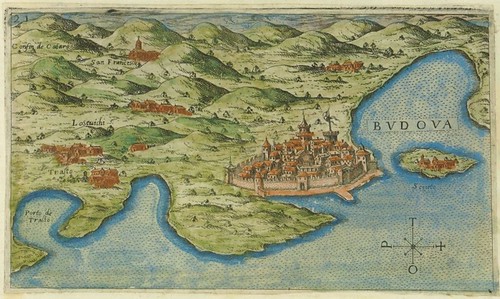
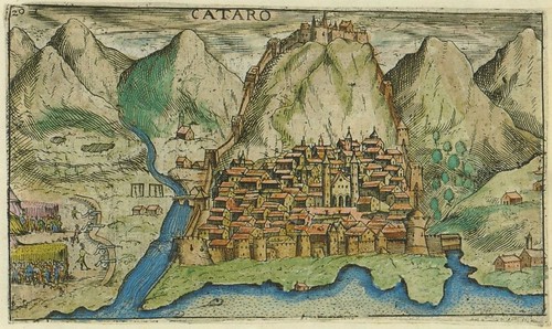
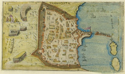
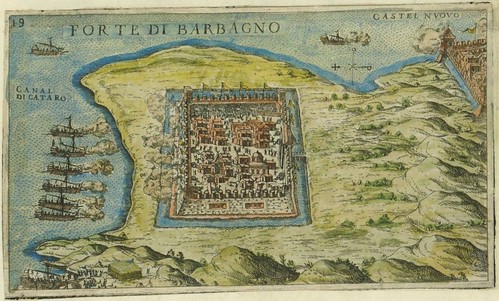

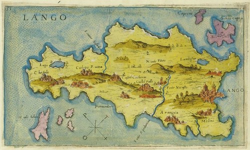
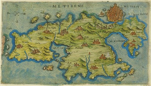
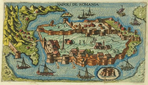
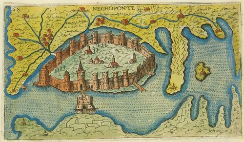
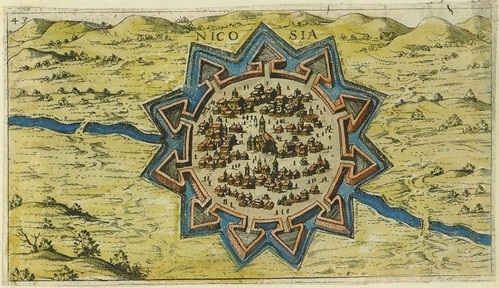
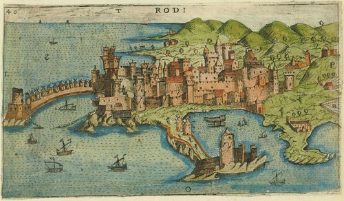
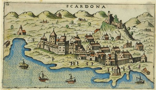
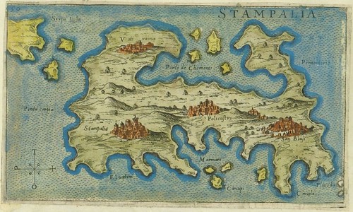
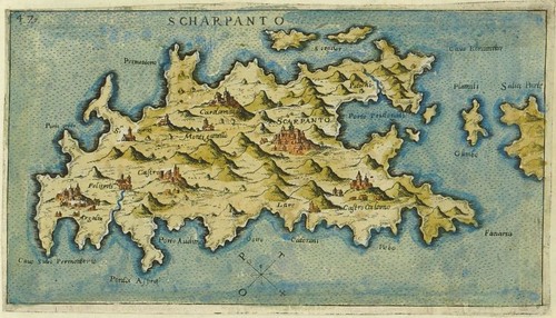
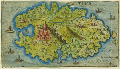


Giacomo (Jacomo) Franco (1550-1620) spent his whole life in Venice where he worked as a cartographic engraver and publisher in the family business. Although there is scant background material online, evidence for his mapmaking competence can be inferred from the noted cartographer Abraham Ortelius having relied on a Franco map as a reference source.
The array of hand-coloured engravings seen above are from a (presumably) draft collection of illustrations engraved by Franco in 1597 that would be formally published the following year. The book in which they would appear -- 'Viaggio da Venetia a Constantinopoli per Mare' (Voyage from Venice to Istanbul by Sea) -- was ostensibly a navigational guide that saw a number of editions. The accompanying text was supplied by the humanist cartographer Giuseppe Rosaccio and included economic, historical and travel-related details in addition to the navigational notes.
The Viaggio plates (64 in the informal 'Carte Geografiche' suite) depict all the major cities, islands and visible landmarks along the recommended sailing route through the Adriatic, Ionian, Mediterranean and Aegean Seas [map].
Croatia's National and University Library in Zagreb host the 'Carte Geografiche' -- click on the image to launch the painless flash interface or the inside margin list for small images of Croatian towns. All the images above are screencaps: the first and last depict Venice and Istanbul respectively, but the rest are probably out of order.
Previously: cartography
skip to main |
skip to sidebar


analytics
Books~~Illustrations~~Science~~History~~Visual Materia Obscura~~Eclectic Bookart.

Contact | Who?
Recommended Blogs
Blog Archives
Resource Sites
- digital nz
- library of congress
- british library
- library france
- library holland
- library spain
- library portugal
- european library
- library australia
- collections canada
- digital poland
- nypl digital
- botanicus digital
- v&a collections
- britmuseum prints
- smithsonian search
- smithsonian galaxy
- f.a.m.s.i.
- casglu'r tlysau
- rumsey collection
- manuscript catalogue
- digital scriptorium
- cesg manuscripts
- swiss manuscripts
- pecia mss blog
- digital book index
- rare book room
- online exhibitions
- primary sources
- worldcat search
- library directory
- digital librarian
- intute resources
- warburg institute
- lexilogos links
- digiwiki links
- museum blogs
- book arts web
- culture archive
- conservation articles
- art-history timeline
- visual arts
- arts journal
- artcyclopedia
- ukiyo-e
- calligraphy megapage
- penmanship
- woodblock
- coconino
- alchemy website
- health hist. img-banks
- health history links
- history network
- new advent






6 comments :
Beautiful! Google Maps doesn't have a hope...
(Oops...here's a comment I accidentally deleted. Thanks George!):
George said:
Interesting stuff! I recently came across a podcast that seems to resonate with these images. The Canadian Broadcast Corporation's (CBC) program Ideas is running a series called "Making Publics". One of the episodes addressed the importance of maps for Early Modern Venice. Books of Turkish costumes even get a mention! The show's description is available on the CBC site and the Making Publics website links to the podcast.
Here are the places between Venetia and Constantinopoli with modern names. I had Wikipedia and Google Maps ready too, but they made the post too long.
Fortezza di Santa Maria di Tremiti: Isole Tremiti, Italia
Lango: Kos, Greece
Metileme: Mytilene, Greece
Napoli de Romania: Napflion, Greece
Negroponte: Chalkis, Euboea, Greece
Nicosia: Nicosia, Cyprus
Rodi: Rhodes, Greece
Scardona: Skradin, Croatia
Stampalia: Astipalea, Greece
Scharpanto: Karpathos, Greece
Tine: Tinos
Zarra: Zadar, Croatia
Good on you jhi! I had been thinking of doing that (and it was going to be difficult: I'm fairly ignorant about that part of the world) but had to go out so I just posted it as-is.
Brilliant, beautiful post (as always) Thank you so much, you made my day!
These are amazing! There's currently a map exhibition at the British library that's worth a look.
Post a Comment
Comments are all moderated so don't waste your time spamming: they will never show up.
If you include ANY links that aren't pertinent to the blog post or discussion they will be deleted and a rash will break out in your underwear.
Also: please play the ball and not the person.
Note: only a member of this blog may post a comment.