Sunday, February 20, 2011

Buffon's Beasts

The plates below are from a 1753 work called 'Collection des Animaux Quadrupèdes' which forms part of an enormous 36-volume series ('Histoire Naturelle') issued over a forty year period by Georges-Louis Leclerc, Comte de Buffon.


Giraffe


Bat on all-fours


Red-shanked douc (old world monkey)


Tarsier


Sloth


Flying Squirrel


Ferret


Polar Bear


Canadian Mole


Jerboa


Long-eared mammal


Bengal Caracal


Hippopotamus


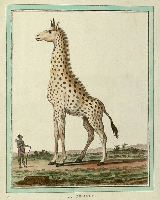
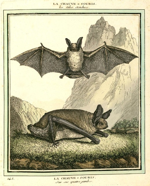
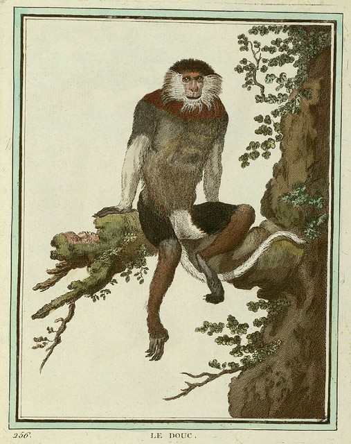
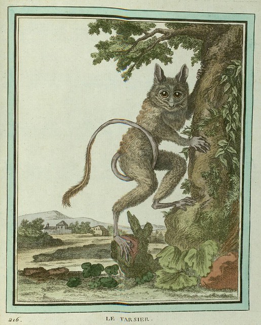
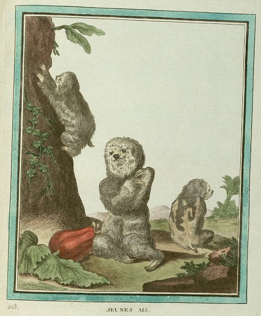
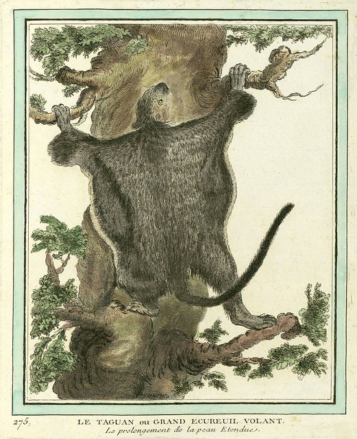
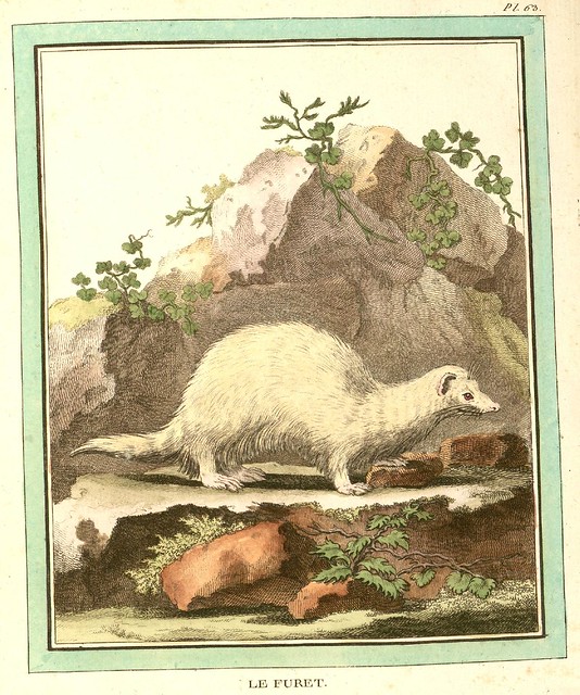
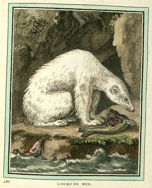
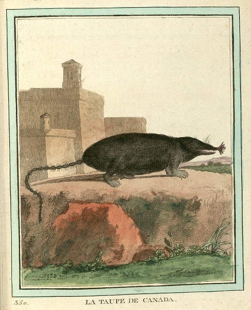
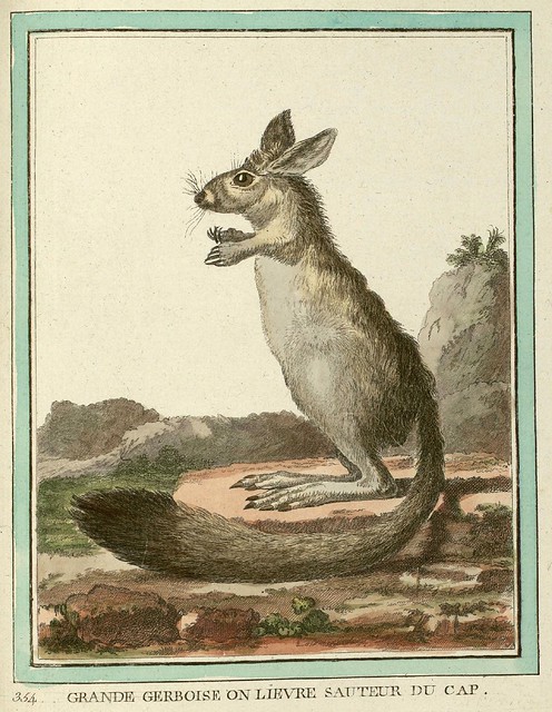
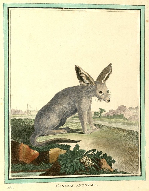
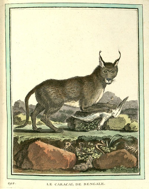
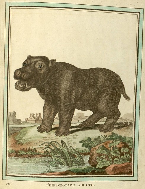
[Click through for larger versions of these moderate-to-heavily stylised hand-coloured quadruped engravings. The illustrations are slightly cropped from the full-page layout and some of the background spotting has been reduced. Mouse over for best guessed animal title. Let me know if you disagree or have a better idea. I'll probably upload a bunch more to the set on flickr during the coming week.]

"No single naturalist of the 1700s epitomizes the revolutionary changes that the Enlightenment brought to the study of nature more than Georges-Louis Leclerc, Comte de Buffon (1707-1788). In the 1600s most naturalists believed the world was a few thousand years old and that species were created separately and organized into an unchanging hierarchy, with humans positioned just below the angels. In the 1800s, Darwin described a world that was inconceivably old, one in which life gradually changed from one form to another without any need for direct supernatural intervention. Roughly midway between those two views—both chronologically and intellectually—was the remarkable Georges-Louis Leclerc Buffon.

Buffon’s career centered on a single enormous project: an encyclopedia he called Histoire Naturelle, which he planned to contain everything known in his day about the natural world. (Buffon only managed to publish 36 out of his projected 50 volumes before he died.) To create it, he was able to draw on his own astonishing expertise, which ranged from astronomy to botany, as well as the knowledge of experts he consulted. But in writing his encyclopedia he did not merely parrot the opinions of others. Instead, he tried to explain all of the facts he amassed with overarching theories about the planet and its inhabitants." [source]

Monday, February 14, 2011

Sanborn Fire Insurance Map Typography

Title pages, headings and letterforms clipped, cropped and isolated
from maps and map publications issued between about 1880 and 1920.


"D. A. Sanborn, a young surveyor from Somerville, Massachusetts, was engaged in 1866 by the Aetna Insurance Company to prepare insurance maps for several cities in Tennessee. [..] Before working for Aetna, Sanborn conducted surveys and compiled an atlas of the city of Boston titled 'Insurance Map of Boston, Volume 1, 1867'. [..] The atlas includes twenty-nine large plates showing sections of Boston at the scale of 50 feet to an inch. It is believed to include the earliest insurance maps published by Sanborn.

The success of the Boston atlas and the commission from Aetna must have impressed the young surveyor with the importance of detailed and specialized maps for the fire insurance industry. Following his assignment in Tennessee for Aetna, he established the D. A. Sanborn National Insurance Diagram Bureau in New York City in 1867. 11 From this modest beginning grew the specialized company that has compiled and published maps for the fire insurance industry for more than a hundred years." [source]


Albany, Georgia - April, 1920


Allentown, Pennsylvania - March 1885


Allentown, Pennsylvania 1897
Allentown, Pennsylvania - 1897


Allentown, Pennsylvania October 1891
Allentown, Pennsylvania - October, 1891


Allentown, Pennsylvania 1911
Allentown, Pennsylvania - 1911


Ansonia, Connecticut March 1884
Ansonia, Connecticut - 1884
[example full map]


Aspen, Colorado - February, 1893


Boston, Massachusetts 1867
Boston, Massachusetts - 1867


Brunswick, Georgia - July, 1920


Charlottesville, Virginia - October, 1907


Cincinnati, Ohio 1904
Cincinnati, Ohio - 1904


Colorado Springs, Colorado - 1907


Columbia, South Carolina June 1919
Columbia, South Carolina - June, 1919


Cripple Creek*, Colorado - December, 1908


Denver, Colorado - 1887


Frankfort, Kentucky September 1907
Frankfort, Kentucky - September, 1907


Greenville, South Carolina June 1920a1
Greenville, South Carolina - June 1920


Hallowell, Maine December 1889
Hallowell, Maine - December, 1889


Indianapolis, Indiana 1898
Indianapolis, Indiana - 1898


Indianapolis, Indiana 1914
Indianapolis, Indiana - 1914


Indianapolis, Indiana 1915
Indianapolis, Indiana - 1915


Kansas City, Missouri December 1895
Kansas City, Missouri - December, 1895


Kansas City, Missouri July 1909
Kansas City, Missouri - July, 1909


Manhattan, New York 1911
Manhattan, New York - 1911


Mexico City, Mexico 1905
Mexico City, Mexico - 1905


St. Joseph, Missouri February 1897
St Joseph, Missouri - February, 1897


St. Joseph, Missouri September 1911
St Joseph, Missouri - September, 1911


St. Louis, Missouri August 1909
St Louis, Missouri - August, 1909


Salt Lake City, Utah 1911
Salt Lake City, Utah - 1911


Spartanburg, South Carolina 1923
Spartanburg, South Carolina - 1923


Springfield, Missouri December 1910
Springfield, Missouri - 1910


Tampa, Hillsborough County, Florida, 1915
Tampa, Florida - 1915


Thomasaville, Georgia - May, 1920


Victoria, British Columbia (Canada) 1885
Victoria, British Columbia (Canada) - 1885


Washington DC 1903
Washington DC - 1903


[Click through for large, and often very large, versions. All images above have been fairly extensively background cleaned of stains, stamps and age-related wear and tear (especially those that remain fairly dirty, following the "less is best" restoration motto)]


Sanborn's fire insurance enterprise produced not only excellent and detailed urban maps, but they also maintained an elegant aesthetic in the headings and legends on the maps themselves, and in the title pages of the (larger) city volumes. The ornamental flair is diverse - I don't think any of the examples above repeat type styles - and lends an air of individuality and refinement to each of the towns surveyed.

Although this sort of artistic embellishment was unlikely to have increased map sales on its own, it's a charming addition which will have perhaps made the purchasers feel a sense of pride and a little more secure about their own unique town. And it's certainly in keeping with the cartographic tradition of decorative trimmings.


There are no comprehensive open portals to the Sanborn fire insurance maps. The images above were obtained from many sources, beginning with the links attached to the Wikipedia Sanborn Maps article.

The Library of Congress has a fairly large site devoted to the subject, but there are only a minimal number of accessible maps.

The LoC collection is, however, available via institutional subscription:
"ProQuest Information and Learning's Digital Sanborn Maps, 1867-1970 provides academic and public libraries digital access to more than 660,000 large-scale maps of more than 12,000 American towns and cities"

In digitising their collection in 2002 (which I don't think is available on the open web), the University of Utah outlined their process and included this paragraph:
"Copyright Issues:

No discussion of digital projects is complete without tiptoeing into the quagmire of intellectual property law. The Sanborn Library, LLC owns the largest and most complete collection (over 1.2 million) of historical Sanborn Maps™, and copies from that collection are sold through Environmental Data Resources Inc.9 Prior to beginning our project, Marriott Library Assistant Director for Special Collections, Walter Jones, contacted the Sanborn Library, LLC and requested permission to scan and post all 3,000 maps of Utah in our collection. Permission was denied, and we limited our scanning to those maps in the public domain, i.e., through 1922. There may be hope for scanning more maps, however, as current law states that materials published from 1923-1963 and whose copyright was not renewed are now in the public domain.10

After the digital collection was posted, The Sanborn Library LLC informed us that even the terms "Sanborn" and "Sanborn Maps" are registered trademarks of The Sanborn Library, LLC and that we were required to insert trademark symbols on every occurrence of those words on our website, as well as a statement of that ownership on our main page. We complied."

Wednesday, February 09, 2011

Codex Aureus

9th Century Carolingian Gospel


Evangeliar (Codex Aureus) - golden lion


Evangeliar (Codex Aureus) - BSB Clm 14000 j


Evangeliar (Codex Aureus) - BSB Clm 14000 a


Evangeliar (Codex Aureus) - BSB Clm 14000 e


Evangeliar (Codex Aureus) - BSB Clm 14000 b


Evangeliar (Codex Aureus) - BSB Clm 14000 i


Evangeliar (Codex Aureus) - BSB Clm 14000 w


Evangeliar (Codex Aureus) - BSB Clm 14000 o


Evangeliar (Codex Aureus) - BSB Clm 14000 r


Evangeliar (Codex Aureus) - BSB Clm 14000 t


Evangeliar (Codex Aureus) - BSB Clm 14000 v


Evangeliar (Codex Aureus) - BSB Clm 14000


This parchment manuscript was produced in 879 AD in north eastern France and features the Gospels of Matthew, Mark, Luke and John in Latin. It was made for the Holy Roman Emperor, Charles the Bald.
"It was written out by the monks Liuthard and Beringer. Seven full-page miniatures show the four evangelists, Charles the Bald enthroned, the Adoration of the Lamb and a Christ in Majesty. It also includes twelve canon tables, ten illuminated initials and incipits. The text is written in golden uncial letters, with each page framed."1
The copious decoration is undoubtedly the work of at least three book artists - of varying quality - and is influenced by or modelled after earlier Carolingian manuscripts and designs from a number of major French centres.

 
Creative Commons License